
Warburton
Roadhouse
Fuel, Food and Accommodation on The Great Central Road
Warburton Roadhouse – Local Attractions
Tjulyuru Regional Arts Gallery
Opened in October 2000, the gallery aims to be the regional centre for Ngaanyatjarra culture. The gallery hosts the most substantial collection of Aboriginal art in the country under the direct ownership and control of Aboriginal people. The Tjulyuru Regional Arts Gallery welcomes visitors with an exhibition programme based on the lifestyles, histories and vibrant stories of the Ngaanyatjarra.
The Warburton Collection is currently under exhibition in Shanghai, China.
Gallery Opening Hours
Monday to Friday 8.30am – 4.00pm
Public Holidays & Weekends – Open by Request
Admission to Gallery
By Donation
Contact
Telephone +61 8 89567966
Facsimile +61 8 89567959
Email: info@tjulyuru.com
Website: www.warburtonarts.com

More about Warburton Community
Warburton or Mirlirrtjarra is named after the range of hills (Warburton Ranges) to the north of the community which in turn was named after one of the early European explorers who travelled this region in search of good pastoral land. The community is colloquially referred to as Ranges. The other name for the community is Mirlirrtjarra which is the name of a site nearby. Warburton is the largest of the Ngaanyatjarra Communities and is considered the metropolis of the Lands.
Warburton was the first Community to be established on the Lands as a result of the activities of the United Aboriginal Missionaries (UAM) Will and Iris Wade, who established a base at Warburton in the 1930’s. Prior to the establishment of the Warburton Mission, Yarnangu led a nomadic subsistence life. The movement of people away from this life to a sedentary one at Warburton Mission was a gradual process that began with people’s visits to the mission prompted initially by curiosity and then the promise of food, blankets, medicines and other material items. Later, a prolonged drought drew people into the mission.
In the early days of the mission, rations were given to Yarnangu in exchange for dingo scalps that the missionaries traded for money on their regular trips into the goldfields town of Laverton. This money was then used to buy rations that were trucked back to the mission. This trade was lucrative enough to allow the missionaries to establish a school, a dormitory system, a church, a hospital and several cottage industries. Their main objectives included converting Yarnangu to Christianity and providing them with education, employment and training programs. The ability of the mission to supply Yarnangu with food, blankets, tools and other material items meant that Yarnangu did not need to travel to the goldfields region for trading purposes. As a result the mission stemmed the outward migration that was occurring in this part of the Desert both prior and in the first few decades of the twentieth century.
In 1973 the UAM relinquished control of the Warburton Mission to the incorporated Warburton Aboriginal Community with an elected Aboriginal council. In 1981 the Ngaanyatjarra Council was officially incorporated. Warburton, Irrunytju, Warakurna, Jameson and Blackstone were the first members of the Council.

Ngaanyatjarra Lands
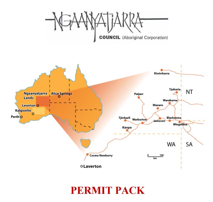
The Ngaanyatjarra Lands comprise a vast area of Western Australia (250,000 square kilometres) adjoining the Northern Territory and South Australian borders. The Ngaanyatjarra Lands are entirely within the state of Western Australia and fall within the Shire of Ngaanyatjarraku, the Shire of East Pilbara and the Shire of Laverton.
The Ngaanyatjarra Lands encompass sections of the Gibson Desert, Great Sandy Desert, Great Victoria Desert, and all of the Central Ranges within Western Australia. These immense areas of spectacular scenery have few obvious signs of human presence. The unique nature of the Ngaanyatjarra Lands, coupled with their remote location, precludes many land management activities that are practiced elsewhere in Australia. There has never been a pastoral industry and, apart from a few activities such as sandalwood harvesting, collection of dingo scalps and prospecting, there has been no other industry. The Ngaanyatjarra people have maintained a continuous association with their country and comprise the majority resident population.


Ngaanyatjarra Council
The Ngaanyatjarra Council is the principal organisation of governance in the Ngaanyatjarra Lands. The Council’s main objective is to provide support for the development of its members (in regard to health, education, housing, law and justice matters, finance and through a variety of commercial enterprises) and to achieve land rights for Ngaanyatjarra people. The Ngaanyatjarra Council’s administrative base is located in Alice Springs.
The Ngaanyatjarra communities operate as a cohesive and co-operative network under the umbrella of the Ngaanyatjarra Council. The Ngaanyatjarra Council endeavours to provide Ngaanyatjarra people remaining on their land with tools to ensure their lands are governed in a relevant and practical fashion that directly responds to their priorities and needs.
Outback Highway
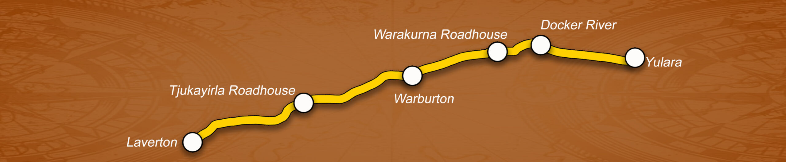
The Outback Way extends 2,800km from Laverton, Western Australia to Winton, Queensland via central Australia. As a self-drive route it passes through central Australia’s deserts, Ayers Rock, The Olga’s, Alice Springs and a host of fascinating places. The Outback Way is made up of seven inter-connecting roads including The Great Central Road (WA); Tjukaruru Road, Lasseter Highway, Stuart Highway and Plenty Highway (NT); and Donohue Highway and Min Min Byway (QLD).


The Great Central Road is the sole form of access to the Warburton Roadhouse. It bisects the Ngaanyatjarra Lands east to southwest, providing access to those living on the lands to two major regional centres – Alice Springs (980 kilometres north east of Warburton) and Kalgoorlie (910 kilometres south west of Warburton). The 2,000 kilometre section of road from Laverton to Uluru National Park is unsealed and subject to wet weather closure.
The best time to travel the Outback Way is during the cooler months from April to October. The route passes through ten bioregions that are each characterised with a unique combination of flora, fauna, geology and landscape characteristics. The Outback Way is also home to The Outback Way-finder Geocache Trail, the World’s longest treasure hunt where a handheld GPS enables travellers to locate thirty four caches hidden at places of interest along the Outback Way.
The Outback Way offers travellers the opportunity to enjoy some of Australia’s icons as well as life in the outback, remote and rugged landscapes and an adventurous journey travelling across outback Australia. The Outback Way is all about the journey and enjoying the unspoilt wonders of Australia’s central deserts and remote outback. Warburton Roadhouse is proud to feature as one of the premier stops along the way.
Trading Hours
Regular Trading Hours
- Monday to Friday - 9:00am to 5:00pm (WST)
- Saturday and Sunday - 9:00am to 3:00pm (WST)
- Closed Christmas Day, New Years Day and Good Friday.
Other Public Holidays – Open 9am to 12 noon (WST), unless otherwise advertised.
No after hours fuel or store.
* Please note that none of the roadhouses across the Great Central Rd are open in the evenings. We advise checking the opening hours of each roadhouse prior to travel, especially if travelling on a public holiday.
Important Notes
- No shop or fuel sales are made outside of trading hours.
- No pets allowed in the grounds.
- (WST) = Western Standard Time.
- All prices are subject to change without notice.
Permit Information
To enter the Ngaanyatjarra Lands visitors require an entry permit. It is also necessary to have a transit permit when travelling through the Lands by road.
The application process is simple and free. You can download a permit information and application pack (PDF format) by clicking on the image below.
Current Conditions
Information Updated : 02/02/2024
Road Conditions : The Great Central Road is open for the purpose of transiting. All Communities are closed to the general public. Please check the Shire of Ngaanyatjarraku for current road condition report of Great Central Road prior to travel: [https://www.ngaanyatjarraku.wa.gov.au/index.php] Please note all other roads are closed. A permit is required to travel the Great Central Road. The Ngaanyatjarra permit application can be found at: [https://permits.ngaanyatjarra.org.au/form/lands-permit] Please contact the Ngaanyatjarra Council (NT) on 08) 89501 711 for further info. DO NOT travel without prior consent and appropriate permits. You may be escorted back where you came from and face fines.
Weather Information : Please refer to [http://www.bom.gov.au/wa/forecasts/warburton.shtml]
Fuel Prices :
Diesel - $ 3.60 per litre
Opal* - $ 3.50 per litre
* Opal is replacement for unleaded petrol. Read more about Opal fuel by clicking here
Copyright © 2024 Warburton Roadhouse | Designed and Hosted by Imageworkx.com